


The Isle Royale Copper Mine operated during the late 19th and early 20th centuries in the hills above Houghton, Michigan, on the Keweenaw Peninsula, in what is known as the Copper Country. Ore was shipped three miles by rail to a stamp mill on the shore of Portage Lake near Houghton, where it was crushed and the pure copper metal extracted. The leftover pulverized rock was dumped through sluices into the lake where it formed the Isle Royale Sands (also called the “Houghton Sands”). Airplanes began landing on this unique flat area starting in the earliest days of aviation; seaplanes could land in the lake nearby and taxi up onto the stamp sands. Soon an official airport was established using the sand as a runway. A seaplane base and float plane dock were added from which tourists were flown to Isle Royale National Park in Lake Superior, 60 miles away. The airport thrived for several decades until closing in 1968. The Houghton Sands are now home to commercial and residential development.
History
The Keewenaw Peninsula, jutting from the Upper Peninsula of Michigan into Lake Superior, was the site of the very first mineral boom in the Americas. In 1842, 6 years before the California Gold Rush, rich veins of copper were discovered and a rush was on to extract the mineral. Over 250 mines were established using eastern and foreign capital. For several decades the Copper Country was the leading producer of copper in the US, and in the early 1900s this small region led the world in copper production. This was mainly because Keweenaw copper is “native copper,” consisting of pure red metal, often forming large masses near or on the surface, but usually found deep underground as a conglomerate with other minerals or in tiny pockets in the surrounding rock called amygdaloids. Processing amygdaloid ore required pulverizing the rock in stamp mills, with the sand-like waste rock dumped into piles or into nearby rivers and lakes. The waste rock contains toxic heavy metals, and a century and a half later vast expanses of bare stamp sands can be seen, with little or no vegetation growing on them. (Look for these in Google Earth, notably along Lake Superior south of Gay on the southern shore of the Keweenaw).
The Isle Royale Copper Mine was established in 1852 to exploit the copper deposits on the island of Isle Royale in Lake Superior. Copper had already been mined on Isle Royale in open pits by the indigenous peoples for thousands of years. Tools and trinkets made from Isle Royale copper have been found all over North America, distributed through elaborate (and still poorly understood) trading routes long before the arrival of Europeans. The island was not a viable commercial source of copper, so interest soon shifted to an area on the mainland, in the hills south of Houghton, where several rich veins of copper were discovered among prehistoric mining pits. Ownership of the mining site changed hands numerous times, but it was always known as the “Isle Royale Mine.” The mine operated nearly continuously until 1925, producing over 180 million pounds of copper. It was briefly reopened during the Depression and closed permanently in 1949.
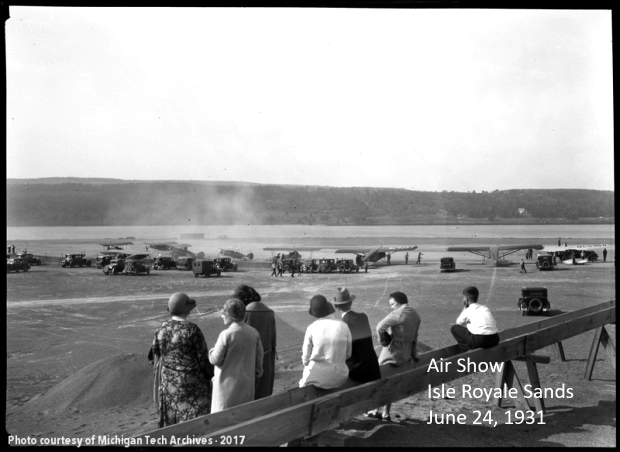
The Isle Royale mine produced amygdaloid copper, which needed to be processed to extract the pure metal from the surrounding rock. A stamping plant was built on the shore of Portage Lake near the outlet of the Pilgrim River at Pilgrim Point, east of Houghton, and ore was shipped there by rail. The ore was pounded into a sand-like consistency, and the waste was pumped into the lake using sluices where it formed an expanding, drifting mass called the stamp sands. These sands were relatively flat and reasonably dry, and formed an inviting landing spot for airplanes. It is likely that seaplanes began landing on Portage Lake and taxiing onto the stamp sands even before the mine ceased operation in 1925. Wheeled planes were also likely users of the convenient, flat, beach-like area. Clearly, the sands were being heavily used by the late 1920s to early 1930s. Numerous photographs of an air show held on the stamp sands on June 24, 1931 appear in the Michigan Technological University archives. It was quite a production, with many airplanes parked on the sand along with dozens of automobiles and large numbers of people visiting the planes.
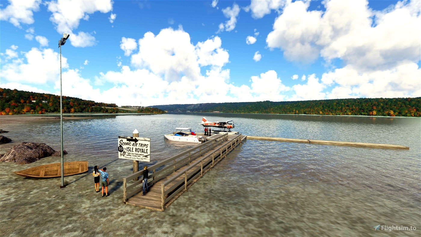
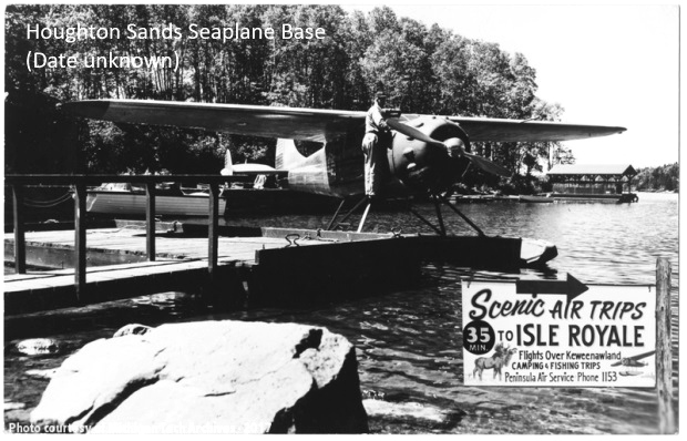
A number of exciting commercial ventures began operating from the stamp sands beginning in 1932. That year D. W. Wescoat purchased a 1928 Sikorsky S-38 flying boat, NC199H, and started the Royale Line, ferrying tourists to Isle Royale, which was not yet a National Park. Seaplane service to Isle Royale from Houghton Sands Seaplane Base continued through at least the 1950s, with operations conducted by Peninsula Air Service. A reference to this operation appears in the August 1959 issue of Flying Magazine. In a letter to the editor, Dale Holbrook says:
I have noticed a recent letter (by Lydia L. Jensen) in June “Mailbox” inquiring about campgrounds near airstrips. I would like to answer in part by giving information on such facilities in the Keweenaw, or the Copper Country of the Upper Peninsula of Michigan. The Houghton Sands Airport and Seaplane base (Lake Superior Sectional Chart) is situated in the midst of many camping areas. Located a mile from the village, it furnishes free tie-downs and has a full time A&E mechanic. Isle Royal National Park, Porcupine Mts. State Park, Fort Wilkins State Park and others can be reached on an average of 30 minutes flight by float-plane from Houghton Sands Airport. At present charter service if desired is offered by Peninsula Air Service in a 195 Cessna on floats.
Floatplane service to Isle Royale continues to this day from a seaplane base located in Ripley, across the lake from the campus of Michigan Tech (formerly the Michigan College of Mines). Isle Royale Seaplanes offers round-trip passage to the National Park using Cessna 206 and De Havilland Beaver float planes. You can check out the MSFS implementation of this seaplane base by spidermanMN on flightsim.to.
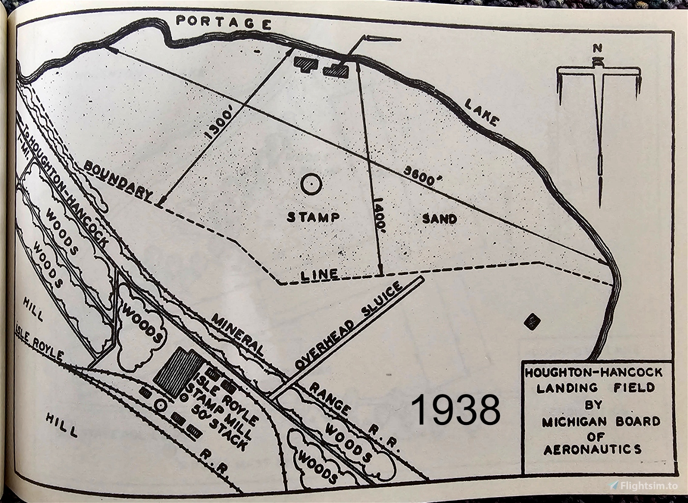
By the early 1930s, an official airport had been established on the stamp sands, called the “Houghton-Hancock Landing Field.” A description in the 1935 publication Michigan Airports and Landing Fields, produced by the Michigan Board of Aeronautics, states:
Houghton-Hancock Landing Field. 1 mile east on shore Portage Lake. Altitude 605 ft. Irregular shape, 3600 ft. NW/SE., 1400 N/S stamp sand, slightly rolling, never wet. Wooden launders, mill and hills south. Wind direction invariably NW or SE. Amphibians can taxi up on field. Small hangar on north. Service day only.
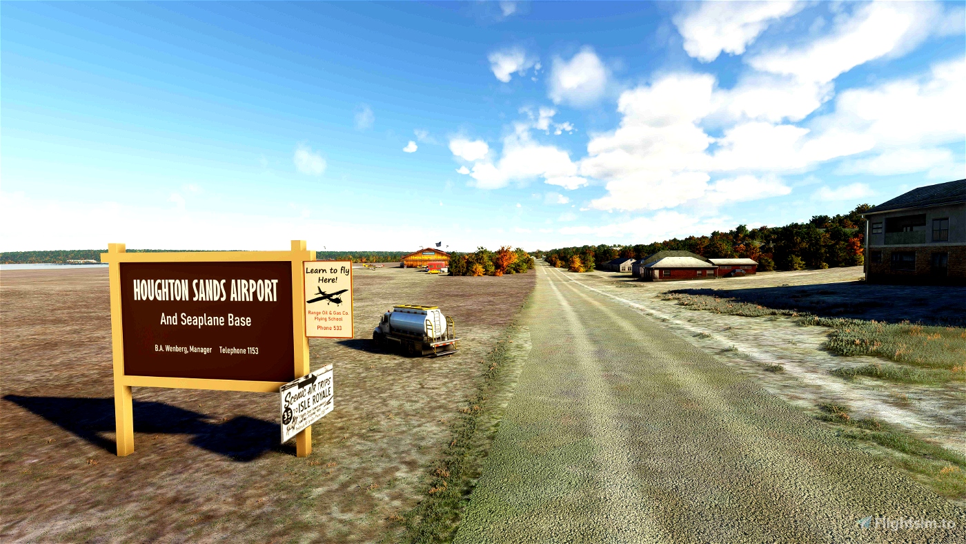
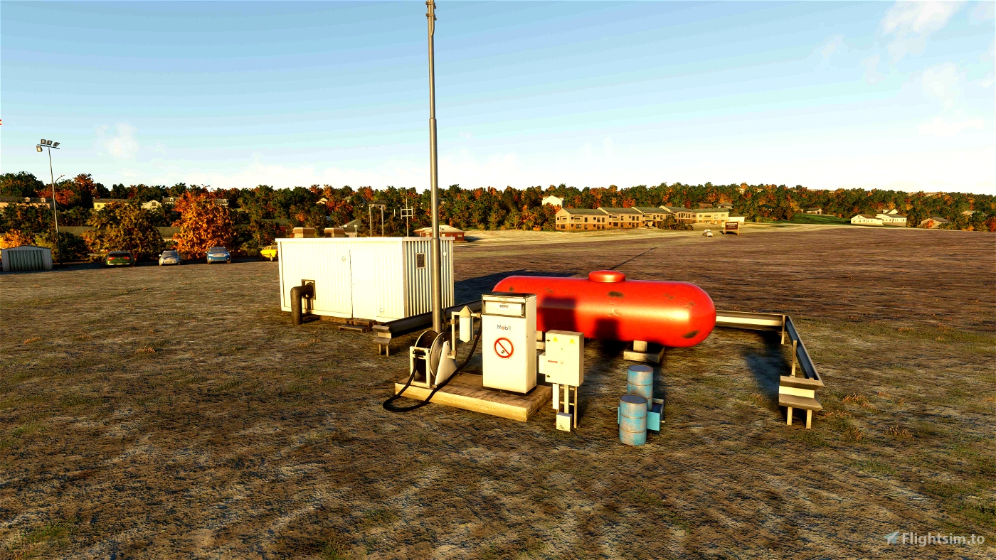
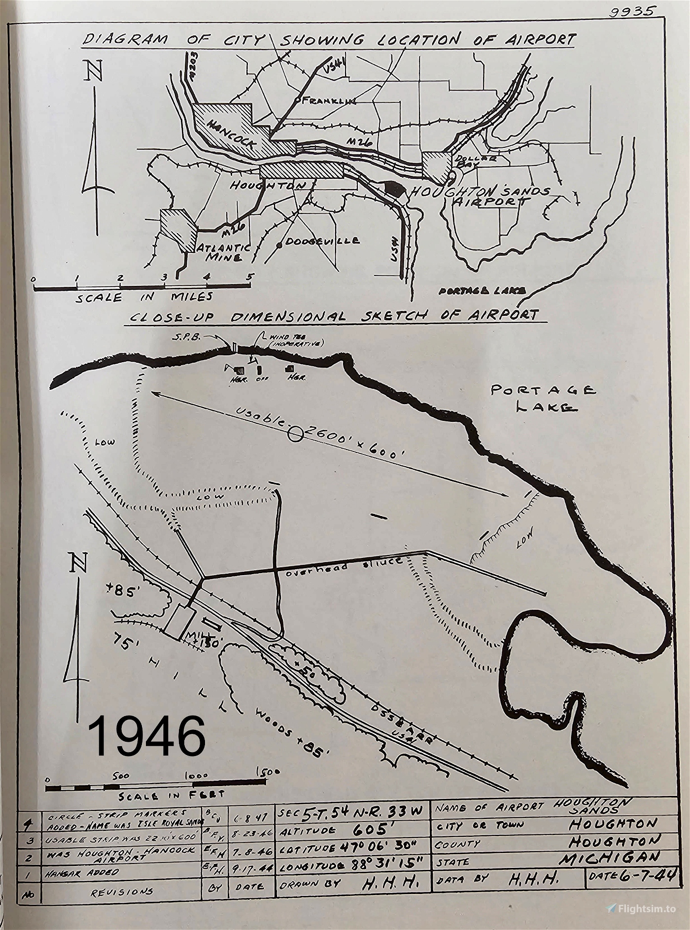
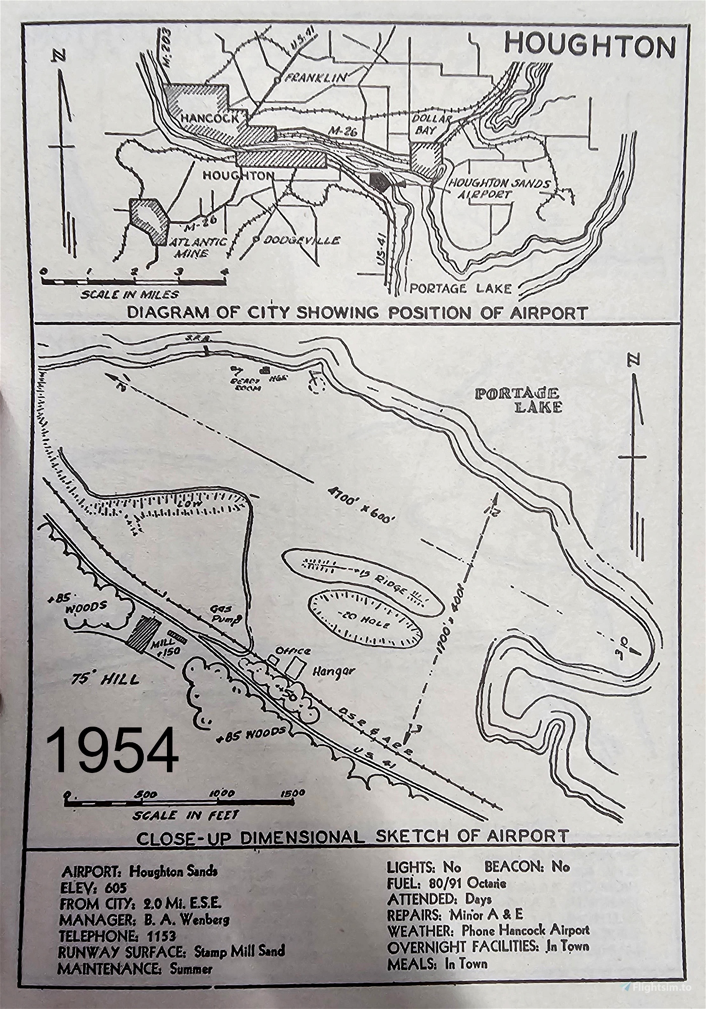
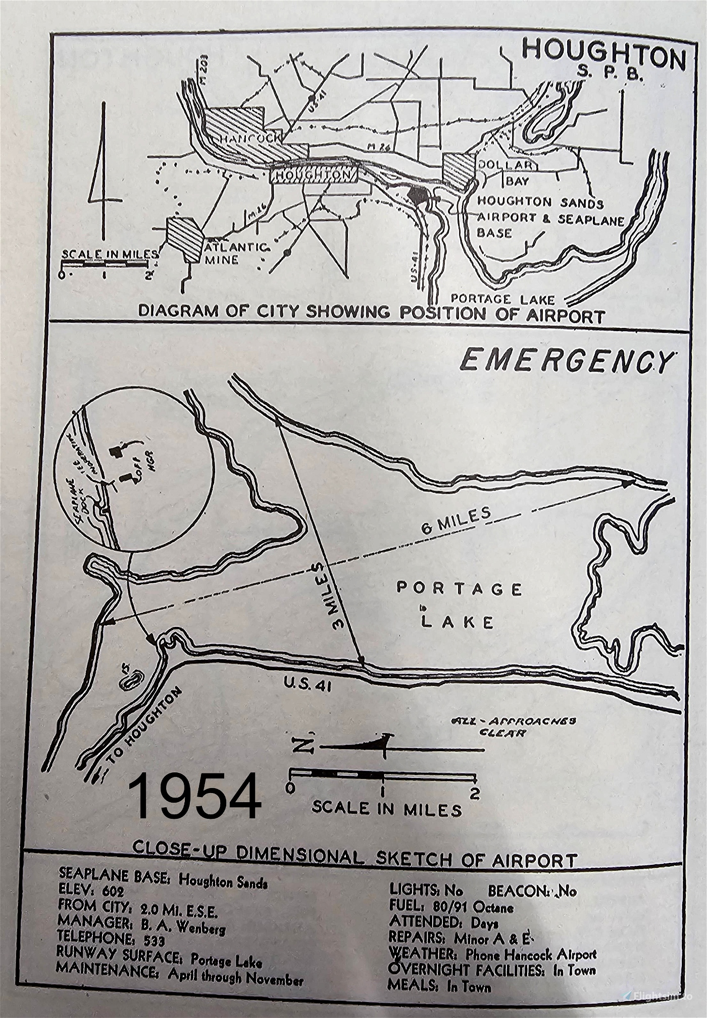
A diagram of the airport appears in the 1938 edition of Michigan Airports, Landing Fields and Intermediate Fields, by the Michigan Board of Aeronautics. The diagram shows the stamping mill south of US 41, with a long overhead sluice extending out over the stamp sands. The airport area is delineated, with two buildings shown near the shore of the lake. The same diagram appears in the 1940 edition of the book. A new diagram appears in the 1950 edition of A Sketch Book of Michigan’s Airports and Landing Fields, in which the airport is called “Houghton Sands.” Two hangars and a small office building are shown near a seaplane dock along the lake. The overhead sluice has been removed and the usable landing area has been expanded. A diagram of the Houghton Sands Seaplane Base also appears in the book showing a north-south water landing area of length 6 miles, and an east-west water landing area of 3 miles. Finally, the 1954 edition of the book “Vacation Michigan by Airplane” shows a diagram of the Houghton Sands airport with two designated landing sites. The first is the 4100 by 600 foot runway 12-30, extending the length of the stamp sands. The second is the 1700 by 400 foot cross-wind runway 3-21. The stamping mill still stands south of US 41, and an office and large hangar are shown along the north side of the highway. A road/taxiway extends from US 41 along the west edge of the stamp sands, connecting the office and hangar to the seaplane base on the lake. One hangar and a ready room are located near the seaplane dock. A gas pump is situated on the taxiway providing 80/91 octane fuel. Minor A&E repairs are provided on airport.
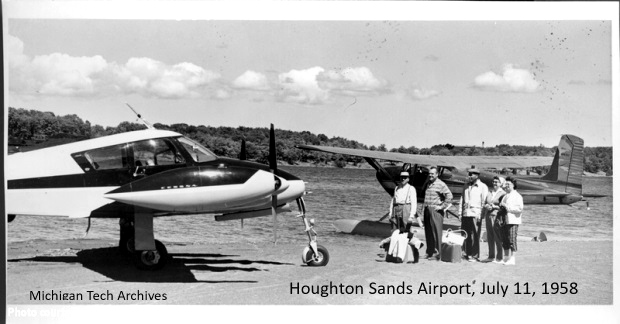
A flying school at Houghton Sands is listed in the 1945 Houghton telephone directory under the entry for the Range Oil & Gas Company. By 1948 the flying school entry is attributed to Lake Superior Aviation, Inc., presumably the FBO at Houghton Sands at that time.
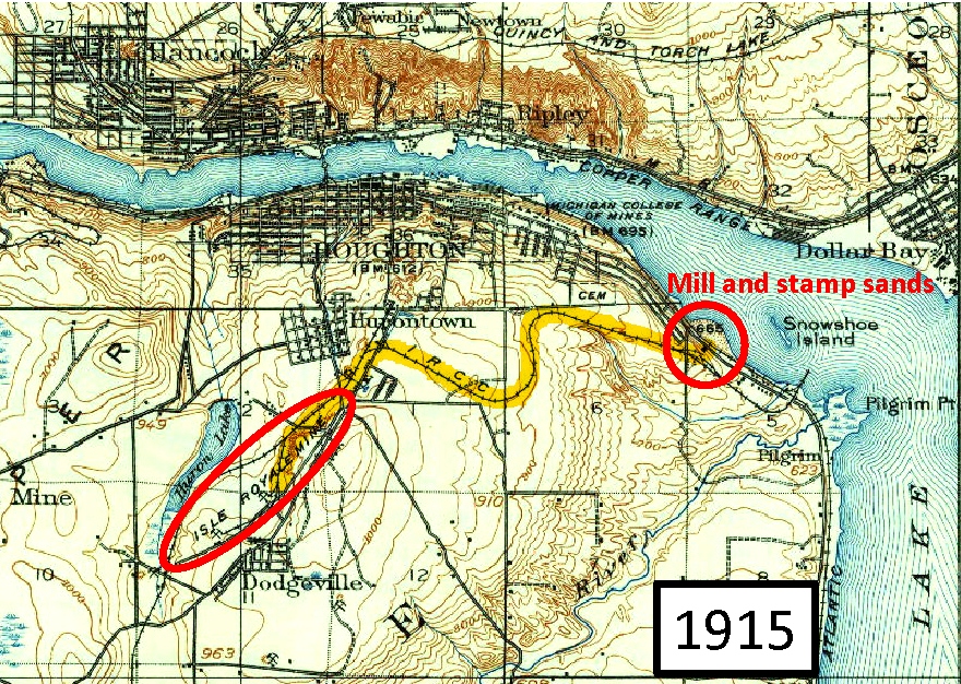
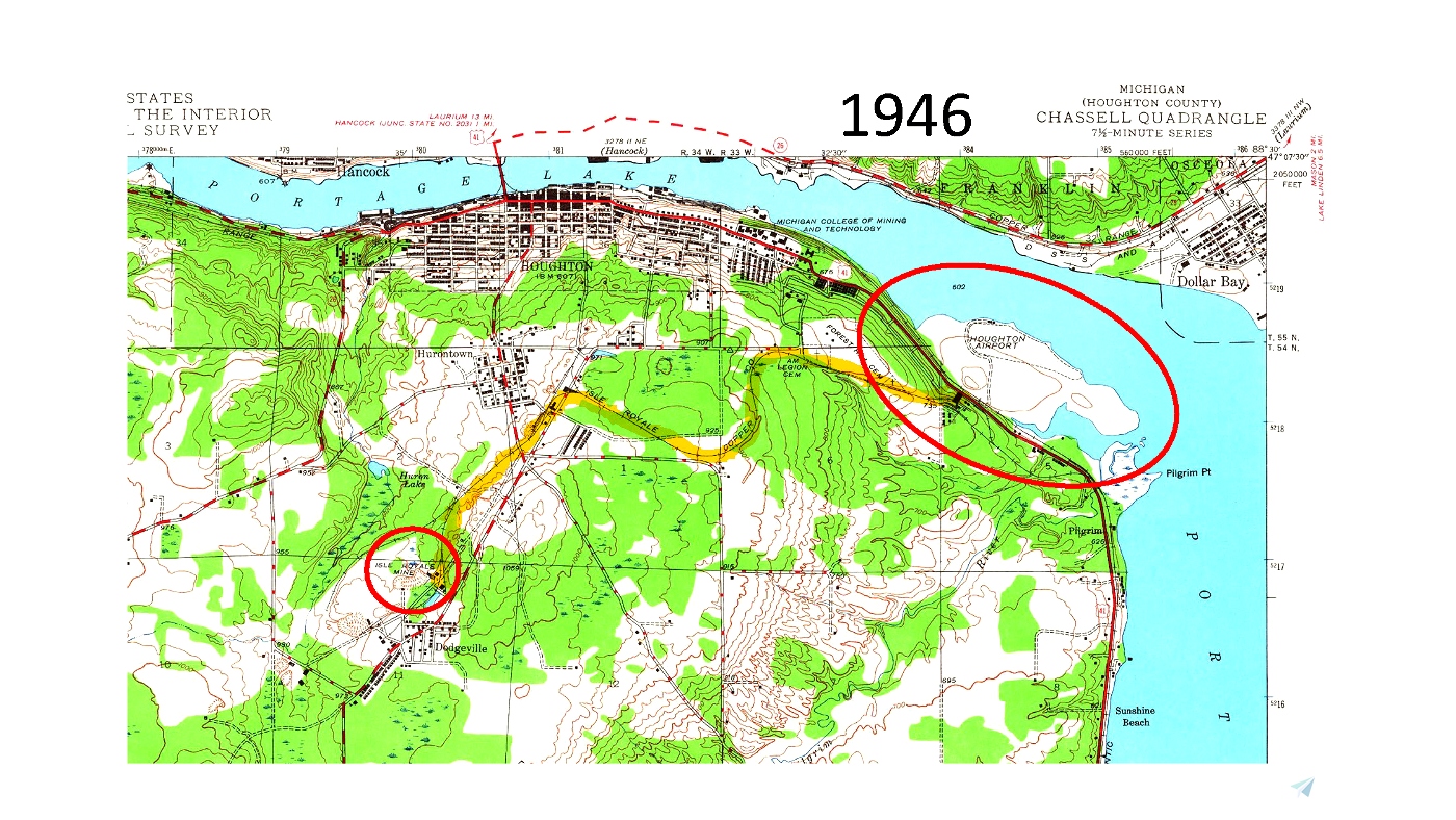
The airport appears as “Houghton Airport” on the 1946 and 1954 USGS maps, and as “Houghton Sands” on the 1961 and 1966 USGS maps. The 1915 USGS map shows the Isle Royale Mine and the railroad track to the stamp mill. The stamp sands are just beginning to protrude into the lake at this time. There is also an extension of the railroad line into the lake – this is where ships offloaded coal to power the mill. Interestingly, there is a fairly large island, called Snowshoe Island, in the lake adjacent to where the stamp sands are forming. The mine and the mill are still indicated on the 1946 map, along with the railroad, but the coal dock and the island have been totally subsumed into the stamp sands. By 1946 the sands are fully formed, and keep roughly the same shape on later USGS maps.
The airport and seaplane base both appear as “Houghton Sands” on the 1949, 1956, 1960, and 1964 editions of the Michigan Aeronautical chart, but neither appears on the 1974 chart. The following entry appears in the December 1967 edition of the FAA AIM/Airport Directory: “Houghton Sands, 2E. FSS: Houghton. 605, 40 (2), S3, F4. Remarks: Open Nov 15-Apr 15 to ski acft.” This indicates that the airport was still operational in 1967, providing service and fuel. However, the December 1968 edition of the FAA AIM/Airport Directory includes both Houghton Sands Airport and Houghton Sands Seaplane Base in the listing of “Closed and Abandoned Airports” as permanently closed. It appears that the airport was not given a 4-letter designation before it closed; I have assigned it the currently unused code of KHSN.
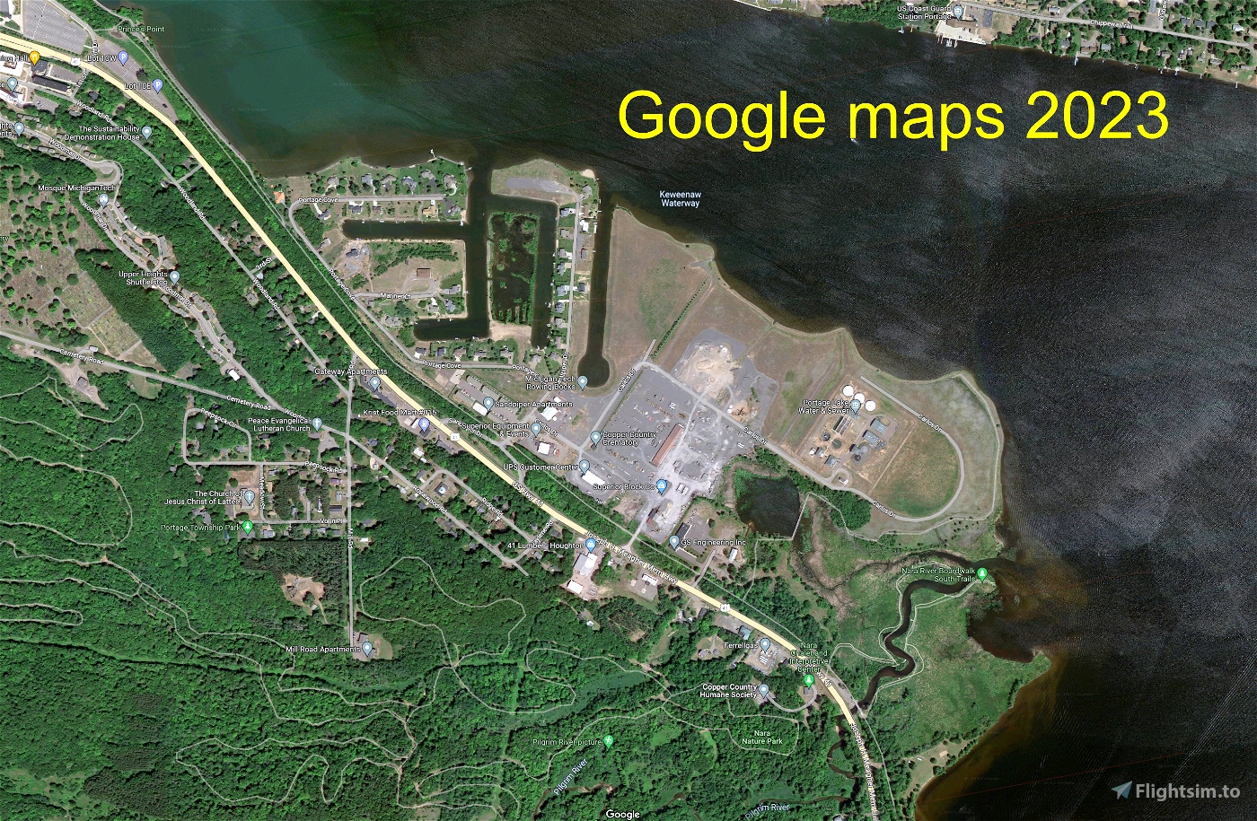
The Isle Royale sands have been repurposed and now hold a large subdivision, several businesses, and a water treatment plant.
The airport as constructed in MSFS
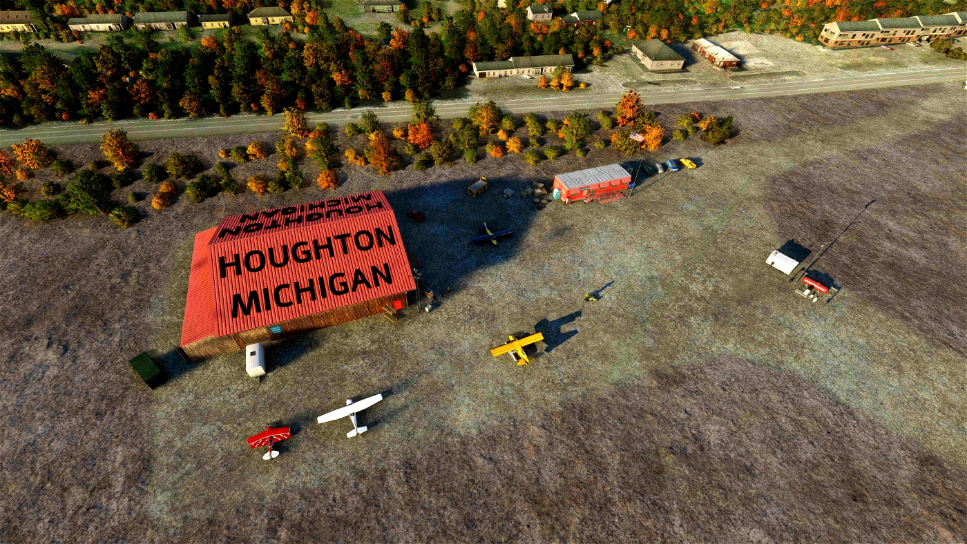
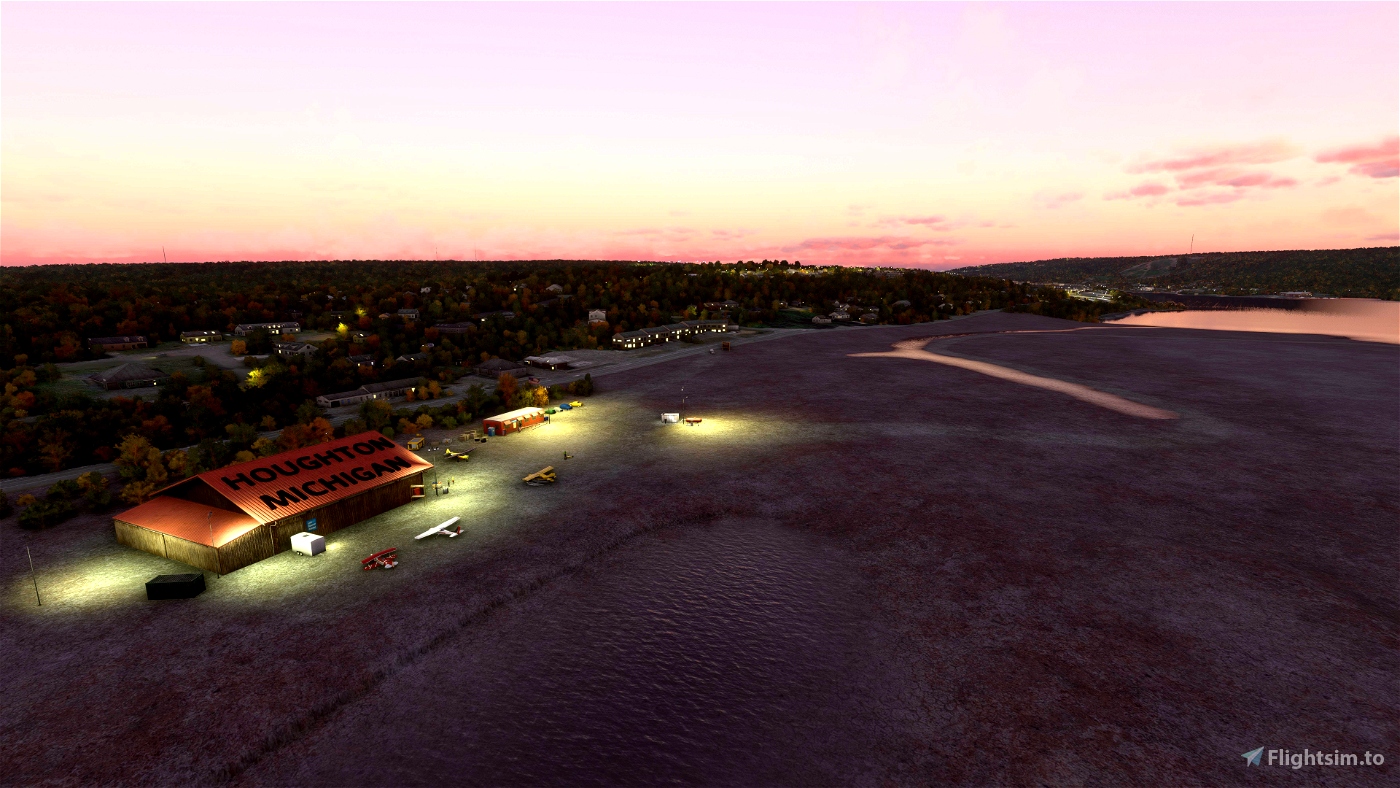
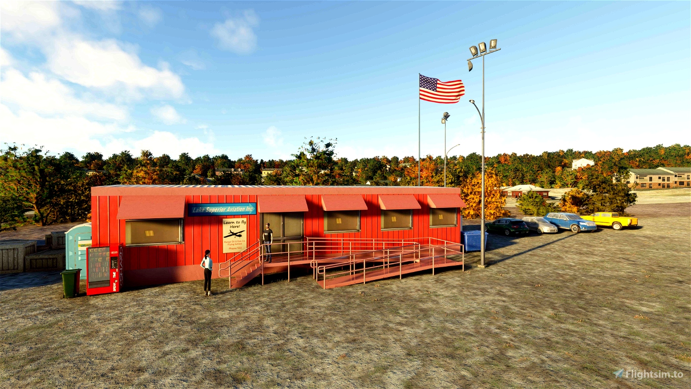
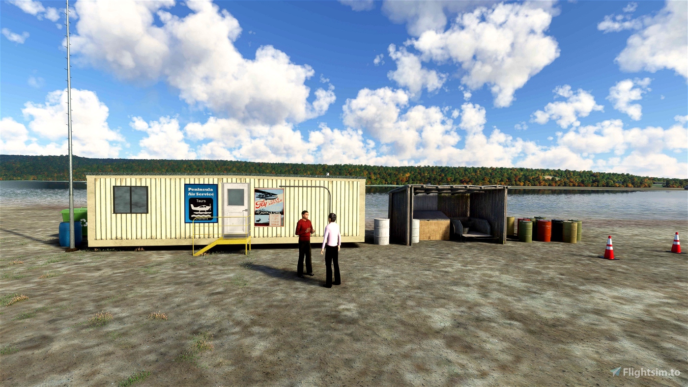
I couldn’t find any photos of the airport, so I used the 1954 airport diagram to construct the airport. There are two main areas – the main hangar area near US-41 and the Seaplane dock on the lake. The main area has a large hangar and an office building, with fuel nearby. The Seaplane dock area has a hangar and a ready room. A gravel road connects the two areas. There are four runways – two land and two water. The land runway material is unimproved stamp sand, and there are no runway indicators beyond some barrels located at the runway corners. The water runways have no indicators. As in the old days, you can land an amphibian and taxi up onto the stamp sands just about anywhere. You may want to use the area between the float plane dock and the ready room, as this gives you the quickest access to the seaplane base facilities.
The stamp sands are fairly flat, but I did not try to flatten any of the rolling terrain. You can taxi nearly anywhere on the stamp sands, but be careful! I added the hole and the ridge near the main hangar, as indicated on the airport diagram, and also the low area south of the taxiway/road. The low areas have standing water to help you identify them.
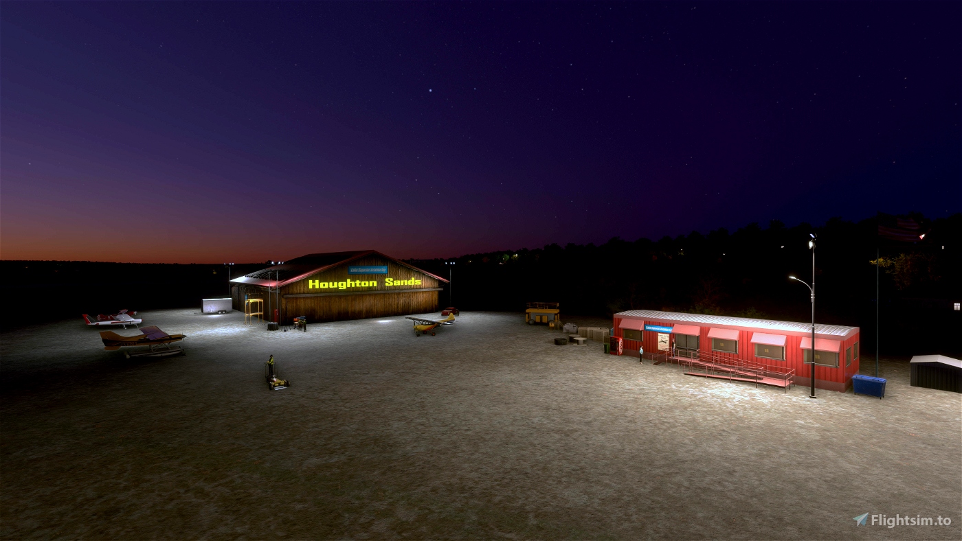
There is no runway lighting and no beacon. It appears that the airport was day-use only. I did add some lighting around the buildings, so you should be able to find the airport at night. However, if you do want to land here at night, pick a clear night with a full moon! And be sure you have a high-intensity landing light.
Notes
To install the airport, unzip and place the folder titled "mulberrywing-airport-khsn-houghton-sands" in your community folder. To see the float plane dock you will need to download the Seaplane Asset Library from flightsim.to and place it in your community folder. Many thanks to 30West for providing this great library!
Between 1840 to 1968, the Keweenaw mines produced over 11 billion pounds of pure copper. Many of the ruined mine buildings are now part of the Keweenaw National Historic Park, which celebrates the heritage of the miners and the mining industry. The miners were often immigrants from mining regions of Europe including Finland, Sweden, Italy, and Cornwall, but also hailed from French-speaking Canada and far-away China. Many of the descendants of the miners still live in the Copper Country, and are strongly attached to the culture of their forebears. Finnish place names abound, and the Cornish pasty remains the traditional ethnic food of Michigan’s Upper Peninsula.
Cheap copper was played out, and the copper boom in Michigan was mostly over, by the end of WWII. A few mines remained in business by processing the stamp sands and extracting the copper that was missed during the original processing. The White Pine Mine, the last of the big Michigan copper mines, ceased operation in 1995. The Eagle Mine, near Marquette (not in the Copper Country), continues to extract minerals from nickel-copper sulfide deposits.
When I arrived to attend college at Michigan Tech in 1977, there was no sign of an airport on the stamp sands. But there was quite a bit of excitement about the possibility of developing the sands with businesses and housing. A favorite pastime for local kids (and Michigan Tech students) was to search through the many huge piles of rock waste at old abandoned mining sites. A little persistence could turn up impressive chunks of pure copper (and maybe a little silver).
It is interesting, but not surprising, that ski planes are specifically mentioned in the airport description. The Copper Country receives the highest annual snowfall of any area in the US east of the Rocky Mountains (averaging about 240 inches a year). In my senior year of college, the Michigan Tech campus received 360 inches of snow, while the town of Delaware, home to the old Delaware mine to the north of Houghton, received 390 inches (nearly 10 meters). Old-timers throughout the country may remember that snow season since Buffalo, New York, was constantly in the news about the astonishing amount of snow that fell that year – 200 inches. Not so astonishing if you’re from the Copper Country.

 MulberryWing


4 months ago
MulberryWing
4 months ago
DELTA301