
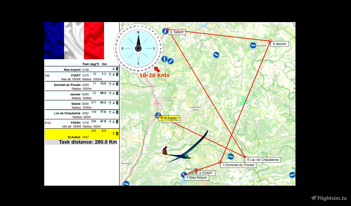


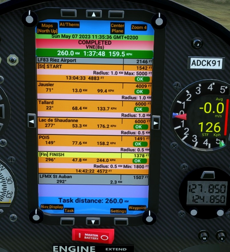


Distance:260km.Length:1-2h.
Difficulty: Medium. .
Departure:LF83
Destination:LFMX
----
Use and look to GPS to validate all crossing points (notification when done).
Use your catapult to take off.
Use and look to GPS to validate all crossing points (notification when done).
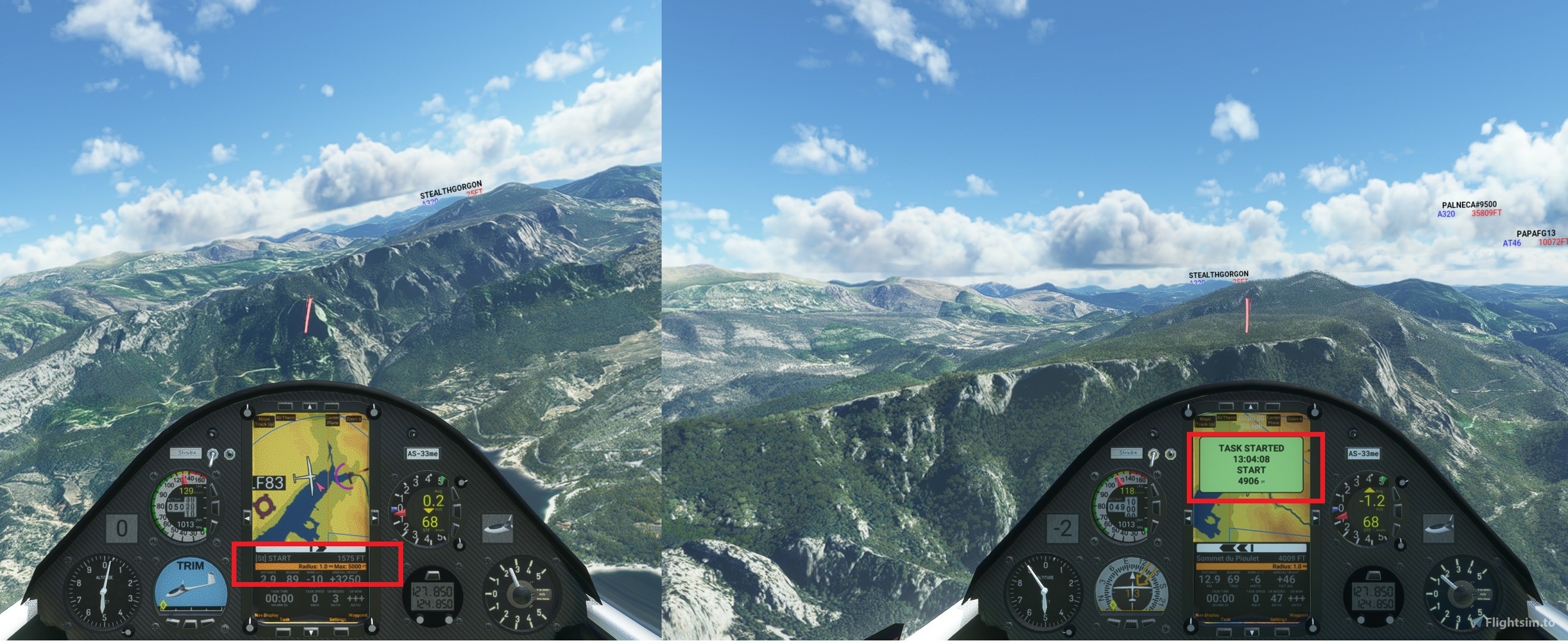
5 000 feet maximum height to pass the POI1 start line.
----
---------------
LF83 Riez Airport 2148 feet
POI1: Starting line. Elevation 5000 feet maximim
POI2 Sommet du Pioulet+4009x2000
POI3 Jausier+6000x2000
POI4 Tallard+6000x2000
POI5 Lac de Chaudanne+2592x1000
POI7:FINISH+1378/1800x1000
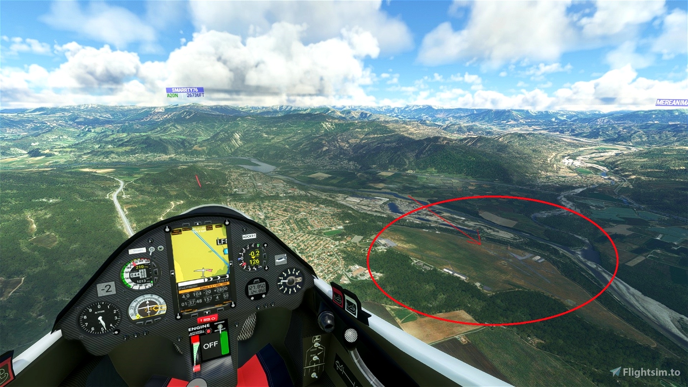
go Landing on St Auban Airport - LFMX 1057 feet
Turn off your main battery when you have landed
AS33me flight in the Verdon. You take off with your catapult from Riez airport LF83.
-----------------------------------------------------------------------
SCC Sim Soaring Club
https://www.twitch.tv/videos/1534299342
https://www.youtube.com/GeorgOrtner
https://www.instagram.com/simsoaringclub/
https://discord.me/simsoaringclub
MADoloSimulations
ASS33 me 1.93
https://fr.flightsim.to/file/15090/as-33-me
https://fr.flightsim.to/file/56083/jonker-js3-rapture
Got Friends
Discus-2c: Premium
https://fr.flightsim.to/product/discus-2c-premium
MSFS ALBATROSS
DG Flugzeugbau DG-808S
https://msfs.touching.cloud/mods/ms-dg-808s/
https://msfs.touching.cloud/mods/kinetic-assistant/

 ADCKillerman


10 months ago
10 months ago
ADCKillerman
Ricochet83
Thank you for this post.
I do not have the impression that the passage on the navigation points are detected by the on-board system.
FMJPA
10 months ago
10 months ago
ADCKillerman
FMJPA