
What secret is hiding behind the Nazca and Palpa Lines, Peru ?
Maybe you can try to find it with a flight from Maria Reiche airport (SPZA), to watch the strange animals that the Nazca people drew between 500 BC and 500 AD.
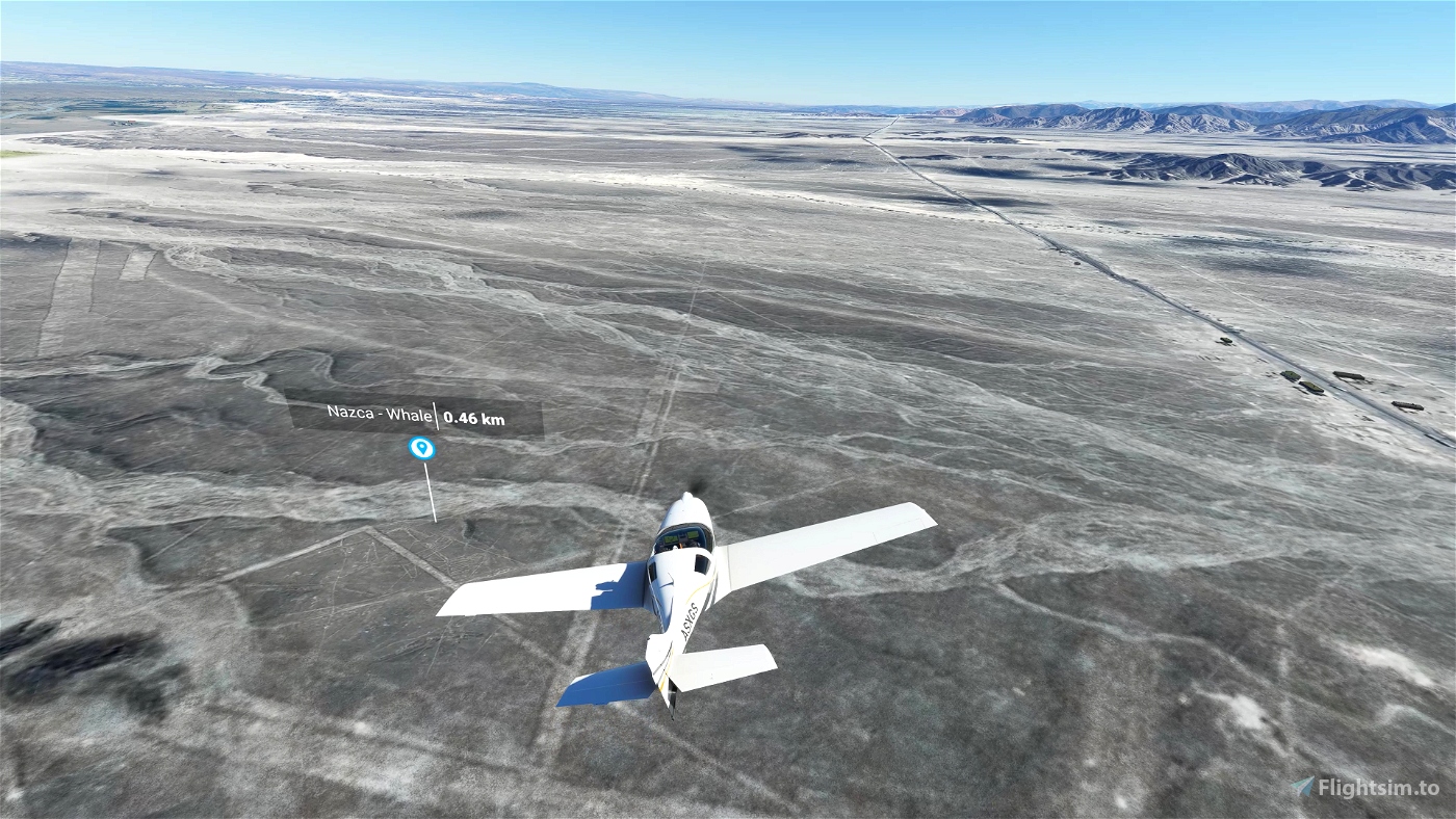
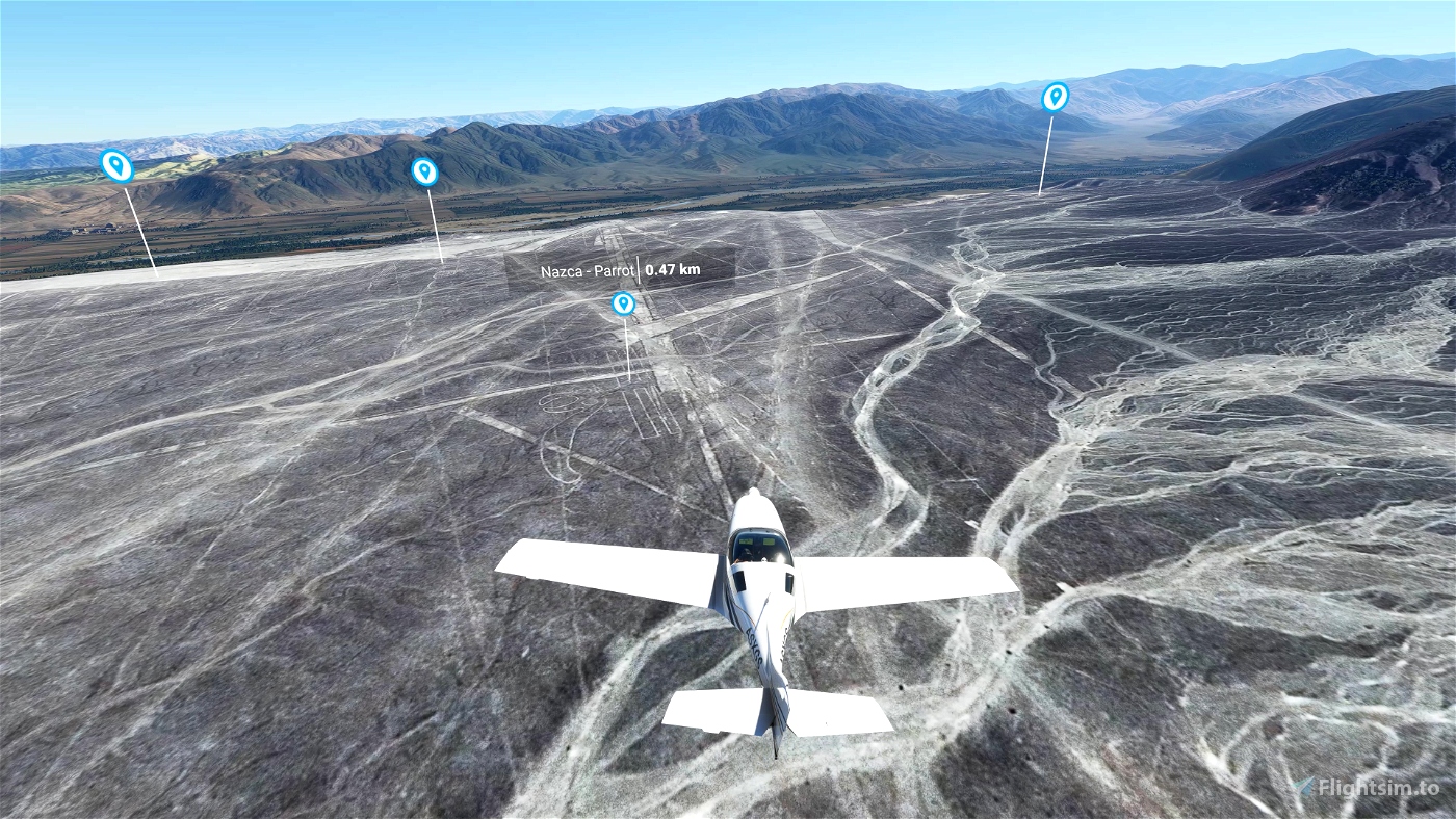
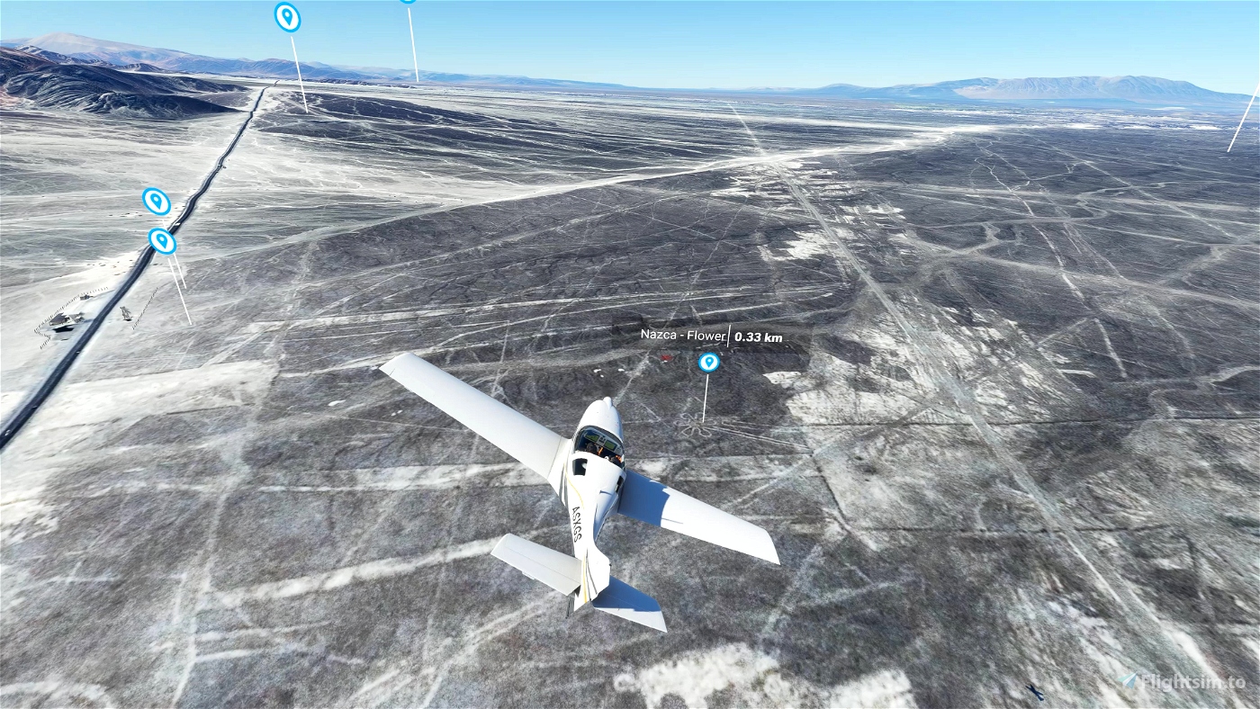
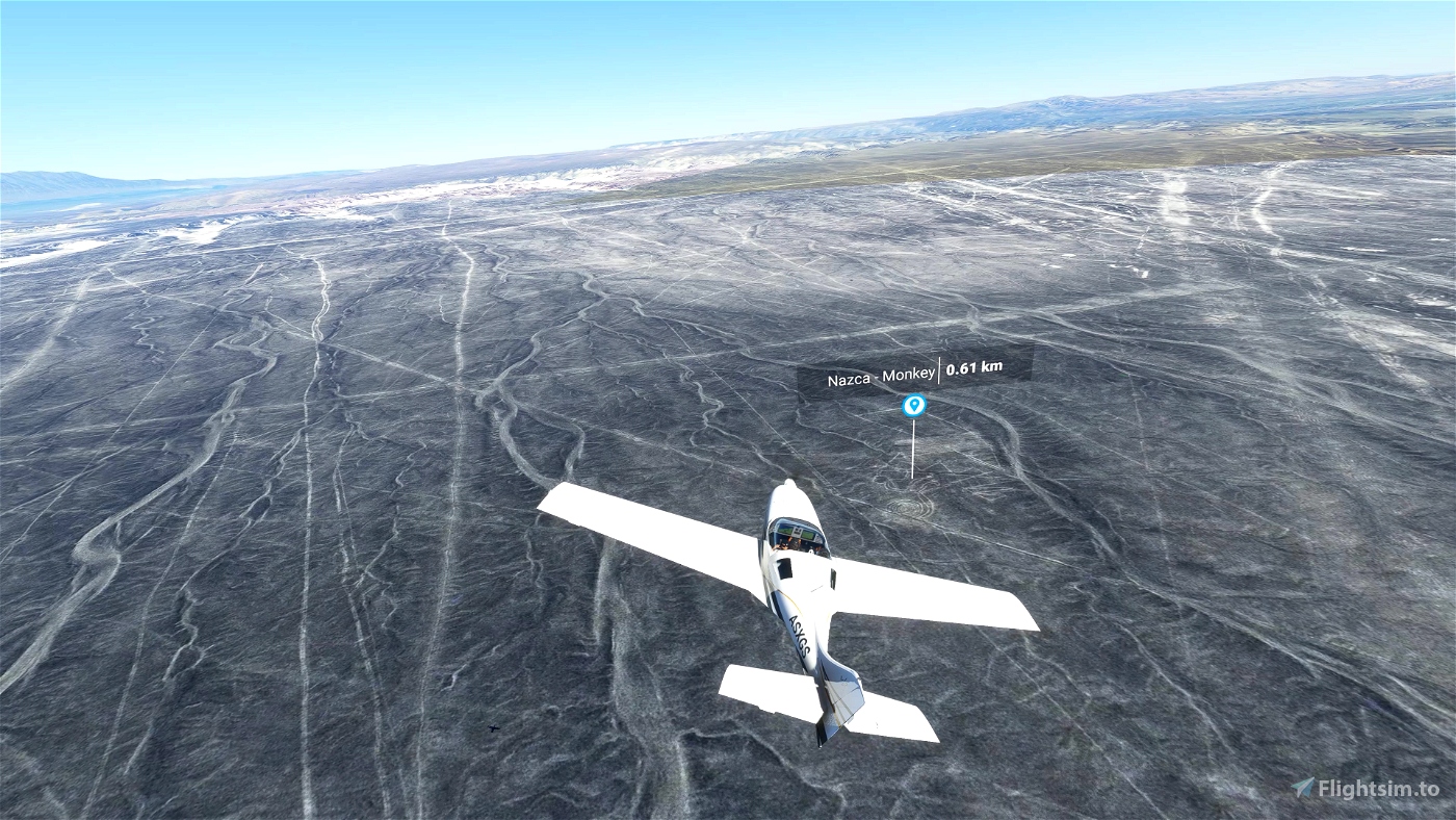
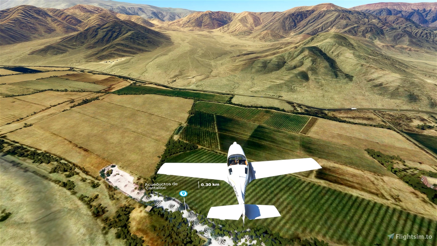
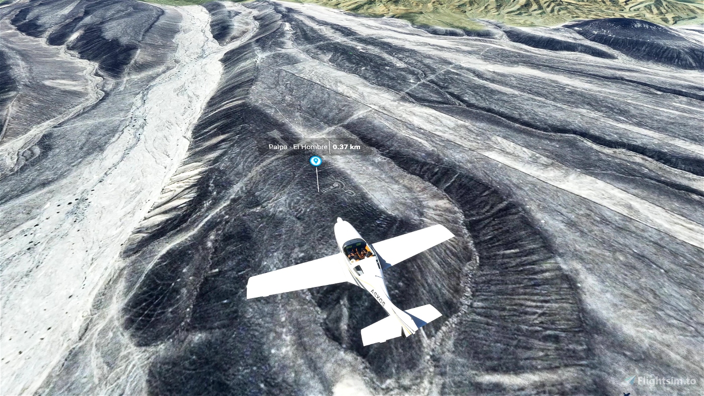
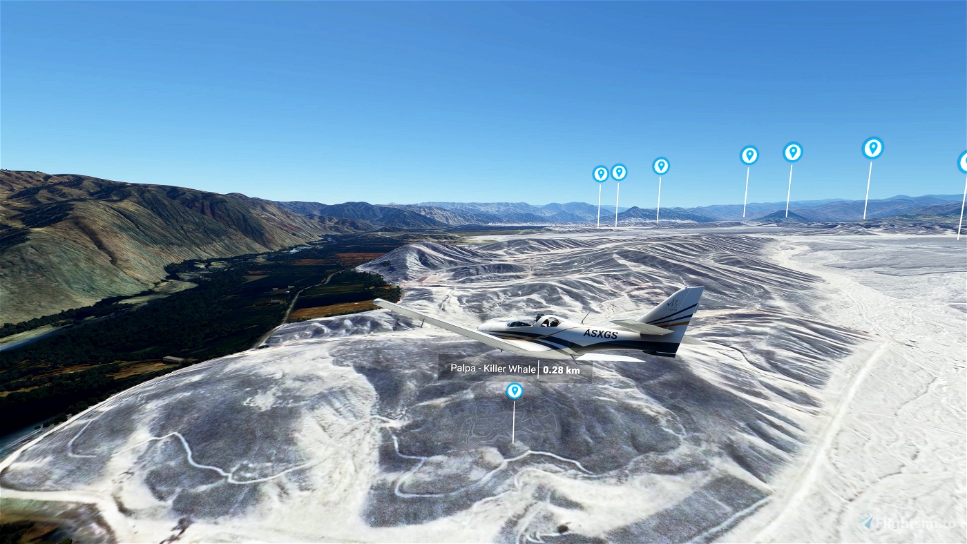
Starting from SPZA, fly north (325°), until you get the 1st POI (the whale, about 5km north). Most geoglyphs are a more in the north (another 15km, follow the Panamerican Road).
New in version 2.0 :
The version 2.0 includes a major update with all Palpa area. Less famous than Nazca, because if was discovered very recently, this area includes many more amazing geoglyphs. The lines are located on the top of the hills (while Nazca were drawn on valleys) and are probably aged 1000 years older than Nazca lines.
The documentation includes :
- more information and external links about history of this area
- map of the geoglyphs
- flight plan files
Required Libraries :
Download and install the “Dave’s 3D People Library” in your community folder.
Installation :
Download all the .zip files (you should get 3, total size 3.8Gb), and install the 6 scenery folders in your Community folder.
If you want to get rid of the POI markers, and find the animals on your own, just delete "droide-nazca-poi" folder.
Flight plan files are to be used with FS2020 GPS or LittlenavMap
For users that already downloaded version 1 : delete version 1, download all files, and make a fresh install.

 droide


I used to smuggle in via google because the Bing data is really bad. Then i found your scene.
Just wanted to do another sightseeing flight, but with the last SU i get a CTD. 😞
Hopefully Bing will get better data soon.
Bt, love your Telescops!
1 years ago
So sorry to hear your CTD issue.
I double checked, no issue on my side with latest updates.
I suggest :
1 years ago
droide
dstar
I love this mod, but I don't install the black and white aerials, even though they are higher resolution than the default. Deserts have wonderfully nuanced colors, but I found that with installing just "droide-nazca-poi" and "droid-nazca" I could have the best of both worlds. Your small, crisp b/w views of the iconic figures overlay the default landscape beautifully, and make it a lot easier to spot them.
At the moment the smaller figures have your great enhanced "ghost" images, and I hope you add the mid sized ones to the package, then it would be just about perfect. Also love the documentation (PDF), SPZA airport and other structures, and flight plans; highly recommended!
2 years ago
Agreed, Google aerial images (provided) have higher resolution, but less colors than original FS2020 images. The problem with original FS2020 is that some geogliphs are not visible
2 years ago
droide
fosheem
Hi, is it possible to release only the POI markers? There is a mod that allows ggle sat data streaming now.
2 years ago
Good point. The package include several folders. You can keep Nazca folder and POI folder, and remove the rest if you are using Google imagery addon.
But the aerials i am providing have been color-retouched, and manually improved on some geoglyphs.
2 years ago
droide
N69BRUH
Must Have Add-On
3 years ago
Foxmike
Lift off from the SPZA airport and flying to the N over the scenery, i don't see any POI's of the interesting places.. very strange - why??
3 years ago
3 years ago
droide
ldbfsxbelgium
A question: It sufficent to downlaod and install the file1 with hat the new version? The other two are unchanged?
The POI-markers are very helpfull, thanks a lot...
3 years ago
No, you have to download and install it all new
3 years ago
droide
machuca99
Departing Nazca airport, what is the heading to the Nazca lines ?
3 years ago
You should fly north until you get the first POI (the whale).
I added a map in the documentation.
3 years ago
droide
Beagle12
AWESOME! Thanks for this location!
3 years ago
Glad to see you enjoy it. It was really missing in MSFS...
3 years ago
droide
jorgemtds
"Download all the .zip files and install the 5 scenery folders in your Community folder...".
There is only 1 folder in your zip.
I have all of Dave's installed. No POI's for me, bummer
3 years ago
Instruction says "all the .zip" files. When you click on download link, two files are proposed. The second one "Nazca_File2_v10_uCx6K.zip" is very important. It includes not only the POI, but also manually retouched areas
3 years ago
droide
Ventingme
Taking off from spza, which heading to fly inorder to see the nazca lines?? (i flu the heading 270, but no lines found (i searched with google maps from the airport spza)
3 years ago
Take off from SPZA and fly heading 325°
3 years ago
droide
ldbfsxbelgium
Why “Dave’s 3D People Library” is need ???
3 years ago
Some tourists are wandering near the sightseeing spots
3 years ago
droide
Spacewolf1
Very nice! I was there with the normal Bing Data, but it was disappointing...
3 years ago
Thanks. Yes indeed, Google Maps is much more acurate
3 years ago
droide
machuca99